Category:Offa's Dyke Path
Jump to navigation
Jump to search
Cymraeg: Llwybr pellter hir sy'n rhedeg ar hyd y ffin rhwng Cymru a Lloegr, neu'n agos iddi, yw Llwybr Clawdd Offa. Cafodd ei agor yn 1971, ac mae'n un o dri Llwybr Cenedlaethol yng Nghymru. Am lawer o'i hyd o 283 km (177 milltir) mae'n dilyn olion Clawdd Offa, y clawdd pridd a godwyd yn yr 8fed ganrif gan y brenin Offa o Mercia, neu'n rhedeg yn ei ymyl.
Deutsch: Der Offa’s Dyke Path ist ein 284 km langer Fernwanderweg entlang der englisch-walisischen Grenze. Er folgt dem historischen Verlauf der mittelalterlichen Grenzanlage Offa’s Dyke durch abwechslungsreiche Landschaft. Südlicher Beginn ist an den Sedbury Cliffs am Severn bei Chepstow, der Weg endet im nordwalisischen Prestatyn an der Irischen See.
English: Offa's Dyke Path (Welsh: Llwybr Clawdd Offa) is a long-distance footpath following closely the Wales–England border. Opened in 1971, it is one of Britain's National Trails and draws walkers from throughout the world. Some of the route either follows, or keeps close company with, the remnants of Offa's Dyke, an 8th-century earthwork, the majority of which was probably constructed on the orders of Mercian King Offa. However, the dyke is not present on the Black Mountains and the path here follows the current Wales-England border along the Hatterall Ridge.
Nederlands: Het Offa's Dyke Path is een wandelpad dat is gelegen op de grens van Engeland en Wales, op of bij Offa's Dyke.

UK long-distance path  | |||||
| Upload media | |||||
| Instance of |
| ||||
|---|---|---|---|---|---|
| Location | Herefordshire, West Midlands, England | ||||
| Length |
| ||||
| Terminus | |||||
 | |||||
Subcategories
This category has the following 6 subcategories, out of 6 total.
Media in category "Offa's Dyke Path"
The following 200 files are in this category, out of 530 total.
(previous page) (next page)-

-
 A bench and the path to Moel Famau - geograph.org.uk - 1028066.jpg 640 × 480; 63 KB
-

-
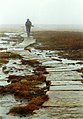
 A lone walker on Offa's Dyke Path - geograph.org.uk - 1108585.jpg 640 × 426; 102 KB
-
 A view from Eaton Coppice - geograph.org.uk - 823584.jpg 640 × 480; 90 KB
-
 Aberwheeler House, near Bodfari.jpg 4,000 × 3,000; 4.74 MB
-
 Above Black Darren - geograph.org.uk - 438352.jpg 640 × 480; 68 KB
-
 Above Prestatyn - geograph.org.uk - 1336082.jpg 640 × 480; 97 KB
-
 Abstieg vom Hay Bluff nach Hay on Wye.jpg 2,272 × 1,704; 2.01 MB
-
 Access Lane from Buttington Tump - geograph.org.uk - 167289.jpg 640 × 480; 94 KB
-
 And on we trudge - geograph.org.uk - 707823.jpg 442 × 635; 57 KB
-
 Approaching Hilltop Plantation - geograph.org.uk - 450397.jpg 640 × 480; 65 KB
-
 Approaching Llanerch - geograph.org.uk - 168368.jpg 640 × 480; 48 KB
-
 Approaching River Trothy - geograph.org.uk - 167875.jpg 640 × 480; 57 KB
-
 Aqueduct on Montgomery Canal.jpg 4,000 × 3,000; 5.03 MB
-
 Ascending Hergest Ridge - geograph.org.uk - 449130.jpg 640 × 480; 67 KB
-
 Ascending Penycloddiau - geograph.org.uk - 1329549.jpg 640 × 480; 99 KB
-

-
 At the end of the day - geograph.org.uk - 709547.jpg 638 × 431; 47 KB
-
 Barn at Little Pool Hall.jpg 4,000 × 3,000; 1.25 MB
-
 Barn at Treveddw Farm nr Pandy.jpg 4,000 × 3,000; 1.07 MB
-
 Bettws Dingle - geograph.org.uk - 437897.jpg 480 × 640; 165 KB
-
 Black Mountain Top.jpg 640 × 374; 77 KB
-
 Bluebells in Wyesea Wood - geograph.org.uk - 167384.jpg 640 × 480; 168 KB
-
 Boundary stone north of Llanymynech.jpg 4,000 × 3,000; 1.88 MB
-
 Bridge 95, Montgomery Canal.jpg 4,000 × 3,000; 1.22 MB
-
 Bridge 97, Montgomery Canal.jpg 4,000 × 3,000; 4.84 MB
-
 Bridge 99, Montgomery Canal.jpg 4,000 × 3,000; 4.85 MB
-
 Bridge at Nantmawr.jpg 4,000 × 3,000; 5.24 MB
-
 Brockweir - Houses near The Quay - geograph.org.uk - 204798.jpg 640 × 337; 306 KB
-
 Brockweir viewed from Madgett Hill - geograph.org.uk - 56245.jpg 640 × 426; 118 KB
-
 Brug Wye.JPG 1,280 × 960; 308 KB
-
 Bwlch Pen Barras - geograph.org.uk - 695062.jpg 640 × 480; 161 KB
-
 Canal South of Pool Quay - geograph.org.uk - 829830.jpg 640 × 480; 71 KB
-
 Caswell Wood - geograph.org.uk - 167311.jpg 640 × 480; 175 KB
-
 Chepstow Castle from Offa's Dyke Path.jpg 1,943 × 1,124; 1.27 MB
-
 Choice of way - geograph.org.uk - 106081.jpg 640 × 480; 91 KB
-
 Churchtown Woods - geograph.org.uk - 825200.jpg 480 × 640; 148 KB
-
 Cider House at Cwm Farm.jpg 4,000 × 3,000; 4.8 MB
-
 Climbing up from Craignant - geograph.org.uk - 911967.jpg 640 × 480; 146 KB
-
 Closed Canal - geograph.org.uk - 654873.jpg 640 × 427; 107 KB
-
 Clwydian Hills - geograph.org.uk - 43226.jpg 640 × 426; 105 KB
-
 Cross Tracks near Mardu - geograph.org.uk - 820934.jpg 640 × 480; 103 KB
-
 Crossroads of footpath and bridleway - geograph.org.uk - 1275539.jpg 640 × 480; 134 KB
-
 Cwm Farmhouse, Llangattock Lingoed.jpg 4,000 × 3,000; 5.26 MB
-
 Cwm-sanaham Hill - geograph.org.uk - 818827.jpg 640 × 480; 56 KB
-
 Cwm-sanaham Hill from the north-west - geograph.org.uk - 823720.jpg 640 × 480; 106 KB
-
 Dechrau a Diwedd (Beginning and End) - geograph.org.uk - 1334711.jpg 640 × 480; 63 KB
-
 Dechrau a Diwedd, Prestatyn.jpg 1,024 × 766; 177 KB
-
 Denehall Farm - geograph.org.uk - 86314.jpg 640 × 426; 151 KB
-
 Derwas Bridge - geograph.org.uk - 831148.jpg 640 × 480; 82 KB
-
 Descending off Hergest Ridge - geograph.org.uk - 449199.jpg 640 × 480; 67 KB
-
 Devil's Pulpit - geograph.org.uk - 124773.jpg 480 × 640; 108 KB
-
 Dirty Dingle - geograph.org.uk - 710602.jpg 431 × 638; 102 KB
-
 Disgwylfa Hill - geograph.org.uk - 86080.jpg 640 × 430; 87 KB
-
 Ditchyeld Bridge - geograph.org.uk - 900976.jpg 640 × 480; 104 KB
-
 Ditchyeld Bridge and Ditchyeld Cottage - geograph.org.uk - 438445.jpg 640 × 480; 127 KB
-
 Ditchyeld Bridge.jpg 4,000 × 3,000; 4.95 MB
-
 Domgay Congregational Chapel.jpg 4,000 × 3,000; 1.47 MB
-
 Domgay House, Four Crosses.jpg 4,052 × 3,070; 1.14 MB
-
 Earth bank near Walterstone - geograph.org.uk - 570977.jpg 640 × 426; 134 KB
-
 East of Llantilio Crossenny - geograph.org.uk - 707671.jpg 637 × 431; 66 KB
-

-
 Eastern summit Disgwylfa Hill - geograph.org.uk - 448381.jpg 640 × 480; 73 KB
-
 Eglwyseg Crags from Offa's Dyke Path.jpg 1,836 × 1,033; 919 KB
-
 Eglwyseg rocks - geograph.org.uk - 237157.jpg 640 × 480; 127 KB
-
 Entering Gladestry - geograph.org.uk - 449108.jpg 640 × 480; 102 KB
-
-
 Fading sign on route of Offa's Dyke Path - geograph.org.uk - 1240878.jpg 640 × 480; 190 KB
-
 Farm Buildings at Bronydd Farm - geograph.org.uk - 191992.jpg 640 × 426; 114 KB
-

-
 Field south of Netherhope Lane - geograph.org.uk - 167353.jpg 640 × 480; 93 KB
-
 Field west of Llanbella - geograph.org.uk - 448417.jpg 640 × 480; 77 KB
-
 Fields near Hay-on-Wye - geograph.org.uk - 444149.jpg 640 × 480; 98 KB
-
 Fingerpost by Full Brook - geograph.org.uk - 168365.jpg 640 × 480; 71 KB
-
 Flying by Permit Only - geograph.org.uk - 307880.jpg 640 × 480; 240 KB
-
 Foel Fenlli from Offa's Dyke Path.jpg 640 × 480; 70 KB
-
 Footbridge on Offa's Dyke - geograph.org.uk - 109911.jpg 640 × 480; 153 KB
-
 Footbridge on Offa's Dyke Path - geograph.org.uk - 2985528.jpg 1,024 × 680; 329 KB
-

-
 Footpath junction in Mopla Road - geograph.org.uk - 524201.jpg 640 × 480; 139 KB
-

-
 Former salt warehouse near Llandysilio 01.jpg 4,000 × 3,000; 1.99 MB
-
 Former salt warehouse near Llandysilio 02.jpg 4,000 × 3,000; 1.11 MB
-
 Frozen moorland, Black Mountains - geograph.org.uk - 1108613.jpg 426 × 640; 103 KB
-
 Furrow Hill - geograph.org.uk - 68480.jpg 640 × 480; 43 KB
-
 Garth Wood, near Monmouth - geograph.org.uk - 606501.jpg 426 × 640; 136 KB
-
 Green Lane near Bronydd - geograph.org.uk - 191988.jpg 640 × 426; 141 KB
-
 Green Lane near Cwm Farm - geograph.org.uk - 168335.jpg 640 × 480; 135 KB
-
 Greenfield House, Four Crosses.jpg 4,000 × 3,000; 938 KB
-
 Greenwood Lodge, Leighton Estate.jpg 4,000 × 3,000; 5.11 MB
-
 Gyrn Hillock - geograph.org.uk - 52137.jpg 640 × 480; 149 KB
-
 Hafod Bilston.jpg 4,000 × 3,000; 1.31 MB
-
 Hatterral Ridge near Llanthony.jpg 7,801 × 1,840; 6.67 MB
-
 Hatterrall Hill (3) - geograph.org.uk - 168389.jpg 640 × 480; 52 KB
-
 Hawthorn Hill - geograph.org.uk - 68474.jpg 640 × 480; 67 KB
-
 Hergan - geograph.org.uk - 322206.jpg 600 × 450; 58 KB
-
 Irishman's Bridge.jpg 4,000 × 3,000; 5.07 MB
-
 Jubilee Tower ruin on Moel Famau - geograph.org.uk - 1030734.jpg 640 × 480; 45 KB
-
 Jubilee Tower-Twr y Jiwbili this way - geograph.org.uk - 306362.jpg 640 × 480; 142 KB
-

-
 Kington - geograph.org.uk - 36252.jpg 640 × 399; 67 KB
-
 Kington 23 - Offas Dyke Way - concrete signpost.JPG 3,008 × 2,000; 3.32 MB
-
 Kissing Gate near the Devil's Pulpit - geograph.org.uk - 752097.jpg 640 × 480; 151 KB
-

-
 Knighton-panorama.jpg 637 × 441; 84 KB
-
 Lane from Gilfach-yr-heol - geograph.org.uk - 447212.jpg 640 × 480; 99 KB
-
 Little Pool Hall - geograph.org.uk - 168323.jpg 640 × 480; 88 KB
-
 Little Pool Hall.jpg 4,000 × 3,000; 1.48 MB
-
 Llandegla Community Shop and Café.jpg 4,000 × 3,000; 1.02 MB
-
 Llwybr Clawdd Offa (Offa's Dyke Path) - geograph.org.uk - 579175.jpg 640 × 480; 98 KB
-

-

-
 Llwybr Clawdd Offa into Coed y Trevor - geograph.org.uk - 1654497.jpg 640 × 396; 105 KB
-
 Llwybr clawdd offa.jpg 350 × 400; 134 KB
-
 Lock Cottage near Pool Quay, Montgomery Canal.jpg 4,052 × 3,070; 1.43 MB
-
 Lock keepers cottage at Carreghofa Locks.jpg 4,000 × 3,000; 4.72 MB
-
 Lock on Montgomery Canal, Pool Quay - geograph.org.uk - 394548.jpg 635 × 476; 75 KB
-
 Lonely fingerpost, Hergest Ridge - geograph.org.uk - 449153.jpg 640 × 480; 59 KB
-

-
 Looking down on Brockweir - geograph.org.uk - 707595.jpg 436 × 639; 68 KB
-
 Lower lock at Carreghofa Locks.jpg 4,000 × 3,000; 4.96 MB
-
 Lower Lock Chamber, Carreghofa Locks.jpg 4,000 × 3,000; 5.27 MB
-
 Lower Spoad Farm.jpg 4,000 × 3,000; 1.45 MB
-
 Lugg Valley near to Dolley Old Bridge - geograph.org.uk - 68485.jpg 640 × 480; 141 KB
-
 Lyonshall Park - geograph.org.uk - 64674.jpg 640 × 457; 40 KB
-
 May divide - geograph.org.uk - 438470.jpg 640 × 480; 121 KB
-
 Mellington Gatehouse.jpg 4,000 × 3,000; 1.38 MB
-
 Moel y Parc.jpg 640 × 480; 84 KB
-
 Moel y Plas - geograph.org.uk - 772468.jpg 640 × 480; 64 KB
-
 MoelFamauSummit(JohnSTurner)Feb2004.jpg 640 × 457; 160 KB
-
 Monmouth from Garth Wood - geograph.org.uk - 36246.jpg 640 × 440; 62 KB
-
 Monnow Bridge over River Monnow at Monmouth.jpg 1,632 × 1,224; 778 KB
-
 Montgomery Canal - geograph.org.uk - 829808.jpg 640 × 480; 120 KB
-
-
 Motte and bailey castle near Brompton Mill.jpg 4,000 × 3,000; 5.1 MB
-
 Muddy farm track - geograph.org.uk - 773625.jpg 480 × 640; 84 KB
-
 Nearly there - geograph.org.uk - 102747.jpg 640 × 480; 64 KB
-
 Nurse Gorlan - geograph.org.uk - 129067.jpg 640 × 480; 95 KB
-
 Offa's Dyke - Tidenham Section - geograph.org.uk - 167307.jpg 640 × 480; 171 KB
-

-
 Offa's Dyke and path, Montgomery, Shropshire, England. View south.jpg 1,920 × 1,080; 837 KB
-
 Offa's Dyke and path, Montgomery, Shropshire, England.jpg 1,920 × 1,080; 762 KB
-
 Offa's Dyke at Burfa - geograph.org.uk - 900461.jpg 640 × 480; 130 KB
-
 Offa's Dyke at Llanfair Hill 01.jpg 4,000 × 3,000; 4.95 MB
-
 Offa's Dyke by Coxbury Farm - geograph.org.uk - 167379.jpg 640 × 480; 70 KB
-
 Offa's Dyke Fingerpost in King's Wood - geograph.org.uk - 169211.jpg 640 × 480; 158 KB
-
 Offa's Dyke Footpath - geograph.org.uk - 30498.jpg 512 × 384; 36 KB
-
 Offa's Dyke Footpath Aifft - geograph.org.uk - 109932.jpg 640 × 480; 103 KB
-
 Offa's Dyke footpath and stile - geograph.org.uk - 1020667.jpg 640 × 480; 67 KB
-

-

-
 Offa's Dyke Footpath at Bodfari - geograph.org.uk - 109913.jpg 640 × 480; 104 KB
-
 Offa's Dyke Footpath Fron-haul - geograph.org.uk - 109923.jpg 640 × 480; 66 KB
-

-
 Offa's Dyke Footpath on Blodwel Rock - geograph.org.uk - 526835.jpg 640 × 480; 158 KB
-

-
 Offa's Dyke footpath, Hatterall Ridge - geograph.org.uk - 195680.jpg 1,024 × 683; 196 KB
-
 Offa's Dyke from the west - geograph.org.uk - 1596649.jpg 640 × 427; 171 KB
-
 Offa's Dyke in Boatwood Plantation 01.jpg 4,000 × 3,000; 3.87 MB
-
 Offa's Dyke in Boatwood Plantation 02.jpg 4,000 × 3,000; 4.02 MB
-
 Offa's Dyke in Danehill Wood.jpg 4,000 × 3,000; 4.83 MB
-
 Offa's Dyke in Shorncliff Wood.jpg 4,000 × 3,000; 4.72 MB
-

-
 Offa's Dyke LDP nearly at Moel Famau - geograph.org.uk - 1030716.jpg 640 × 480; 51 KB
-
 Offa's Dyke LDP signpost - geograph.org.uk - 192005.jpg 640 × 426; 154 KB
-

-

-
 Offa's Dyke Long Distance Footpath - geograph.org.uk - 50962.jpg 640 × 480; 82 KB
-
 Offa's Dyke Long Distance Footpath - geograph.org.uk - 570484.jpg 640 × 480; 139 KB
-
-
 Offa's Dyke Long Distance Path - geograph.org.uk - 50024.jpg 640 × 480; 124 KB
-
 Offa's Dyke looking North - geograph.org.uk - 1198010.jpg 640 × 480; 67 KB
-
 Offa's Dyke near Brynorgan.jpg 4,000 × 3,000; 4.89 MB
-
 Offa's Dyke near Cefn Bronydd.jpg 3,000 × 4,000; 5.04 MB
-
 Offa's Dyke near Discoed - geograph.org.uk - 438553.jpg 640 × 480; 69 KB
-
 Offa's Dyke near Mardu - geograph.org.uk - 820915.jpg 640 × 480; 81 KB
-
 Offa's Dyke north of Clun Valley - geograph.org.uk - 820012.jpg 640 × 480; 90 KB
-
 Offa's Dyke north of Craignant - geograph.org.uk - 919456.jpg 640 × 480; 120 KB
-
 Offa's Dyke north of Pentre-Shannel.jpg 4,000 × 3,000; 4.96 MB
-
 Offa's Dyke north of Trefonen - geograph.org.uk - 913128.jpg 640 × 480; 130 KB
-
 Offa's Dyke on Llanfair Hill - geograph.org.uk - 1247335.jpg 600 × 450; 253 KB
-
 Offa's Dyke on Llanfair Hill - geograph.org.uk - 818860.jpg 640 × 480; 96 KB
-
 Offa's Dyke on Rushock Hill - geograph.org.uk - 450158.jpg 640 × 480; 76 KB
-
 Offa's Dyke Path - geograph.org.uk - 1108665.jpg 640 × 426; 98 KB
-
 Offa's Dyke Path - geograph.org.uk - 1227887.jpg 480 × 640; 115 KB
-
 Offa's Dyke Path - geograph.org.uk - 1417026.jpg 640 × 427; 59 KB
-
 Offa's Dyke Path - geograph.org.uk - 1417045.jpg 640 × 427; 62 KB
-
 Offa's Dyke Path - geograph.org.uk - 1716307.jpg 2,272 × 1,712; 986 KB
-
 Offa's Dyke Path - geograph.org.uk - 1728215.jpg 2,592 × 1,944; 2.52 MB
-
 Offa's Dyke Path - geograph.org.uk - 1728247.jpg 2,592 × 1,944; 2.38 MB
-
 Offa's Dyke Path - geograph.org.uk - 1728268.jpg 2,592 × 1,944; 2.42 MB
-
 Offa's Dyke Path - geograph.org.uk - 1728335.jpg 2,592 × 1,944; 2.6 MB
-
 Offa's Dyke Path - geograph.org.uk - 1728367.jpg 2,592 × 1,944; 2.38 MB
-
 Offa's Dyke Path - geograph.org.uk - 1728397.jpg 2,592 × 1,944; 2.5 MB
-
 Offa's Dyke Path - geograph.org.uk - 1728423.jpg 2,592 × 1,944; 2.46 MB
-
 Offa's Dyke Path - geograph.org.uk - 1728443.jpg 2,592 × 1,944; 2.51 MB
-
 Offa's Dyke path - geograph.org.uk - 200308.jpg 640 × 480; 158 KB
-
 Offa's Dyke path - geograph.org.uk - 200348.jpg 480 × 640; 175 KB
-
 Offa's Dyke Path - geograph.org.uk - 207886.jpg 480 × 640; 92 KB


.jpg)


_-_geograph.org.uk_-_1334711.jpg)


_-_geograph.org.uk_-_1317694.jpg)


_-_geograph.org.uk_-_168389.jpg)


_-_geograph.org.uk_-_579175.jpg)
_south_of_The_Nea_-_geograph.org.uk_-_579184.jpg)


Feb2004.jpg)


